|
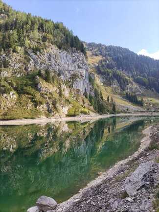
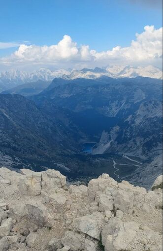
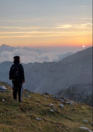
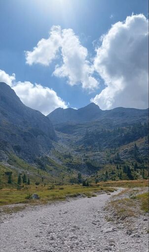
Hey, hey! are you the kind of person that loves the mountains? so this post is for you. I will show you how to reach Krn peak and the best route to do it. Krn is a mountain of the southwestern Julian Alps in northwestern Slovenia. It is the highest mountain of the Krn Mountains. The mountain is located about 50 kilometres from the Adriatic Sea. The Soča River flows west of the peak, and the smaller Lepenjica River northeast and the Tolminka River southwest of it. In the next map, you can see where are the starting point and some interest points like Lake Krn in half the way up and the option you have to sleep and stay during the night: 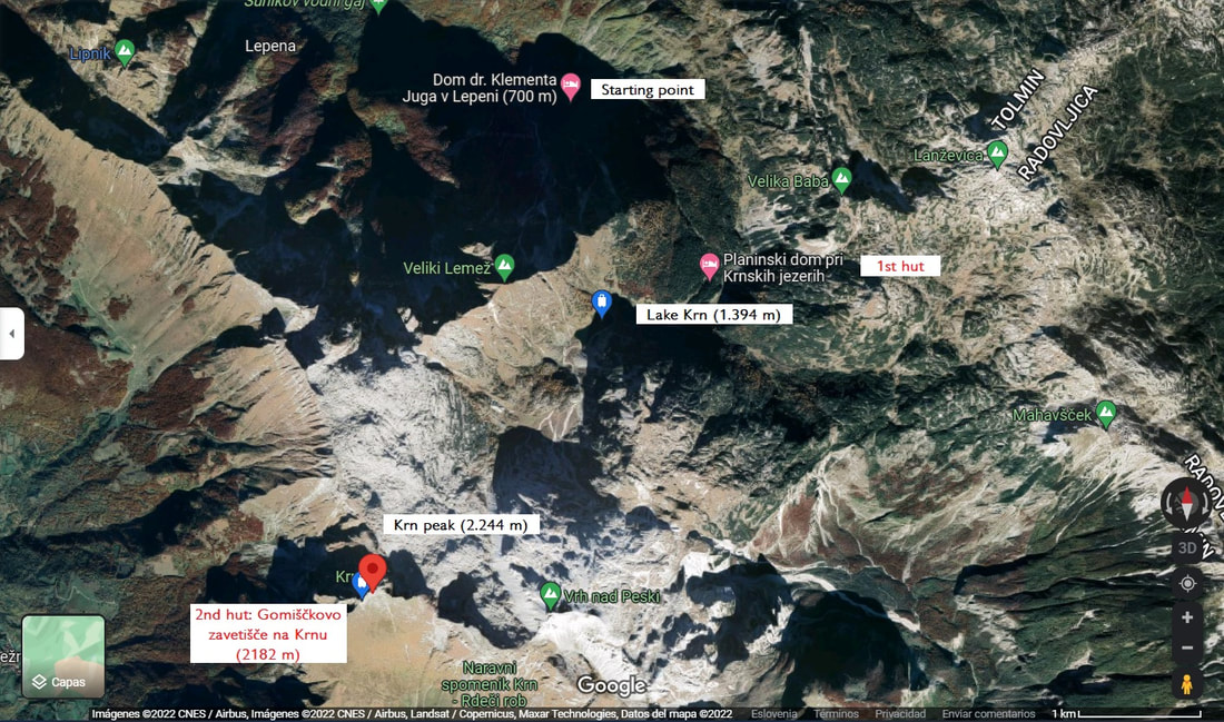 Route details: - Starting point: Dom dr. Klementa Juga v Lepeni (700 m) - ¿parking?: Yes, there is a parking lot next to the Dom Peak high: 2.244 m (6 hours) Lake Krn: 1.394 m (3 hours) - ¿Sunset in the top? Possible -¿Sunrise in the top? Possible - ¿Swim in the lake? Not allow Sleep options (recommended to book in advance): - Planinski dom pri Krnskih jezerih (1st hut): Near to Krn Lake You can book online in this link: https://www.alpsonline.org/reservation/calendar?hut_id=534 - Gomiščkovo zavetišče na Krnu (2182 m) (2nd hut): 15 minutes walking from the peak Is not possible to book online, but you can call them to book https://www.pzs.si/koce.php?pid=41 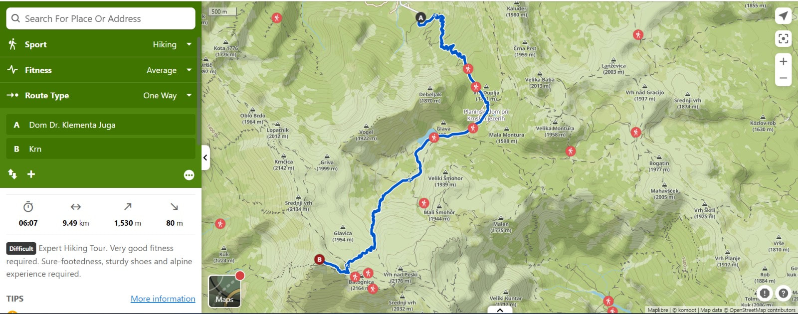 We started the route at 11.30 a.m and we stop at the lake to take some pictures and have a good lunch with food provided by us. All the way is with signals and it is very well indicated during the whole route. It took us 6 hours to reach the peak around 5:30 p.m. The views were really breathtaking!!! We were sleeping and seeing the sunset in the 2nd hut and it is possible to have dinner there but there is no way they can refill the water bottle so I hardly recommend you go with enough water otherwise there is no possibility to refill during the hike. At 5 a.m we woke up because as sunrise lovers we really would like to see it. It is really worth it. On the way, also, it is possible to see the rest of World War I in the "Soška fronta". This battle was fought between the armies of the Empire of Austria-Hungary and the Kingdom of Italy.
Hope all this information can help you!
See u soon, Vicky
0 Comments
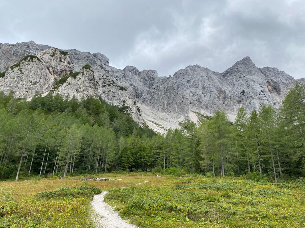
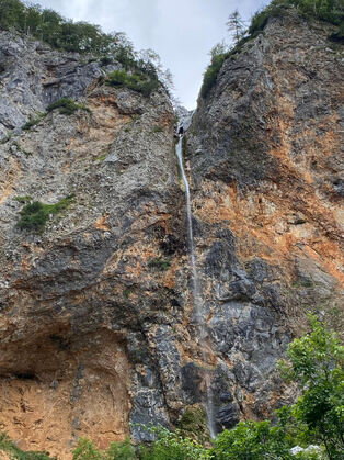
When I came back from my 2 weeks holidays, Vicky and I decided to drive to Logarska Dolina to hike to Mrzla Gora, a summit we had randomly picked on Google Maps. Once we got there, our minds got blown by how beautiful the scenery was: mountains all around us, green grass meadows in the valley, trees surrounding the road, and a waterfall only a few minutes away from the parking lot (which, I have to say, was a little disappointing).
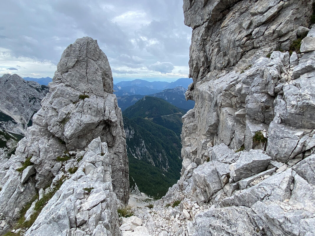
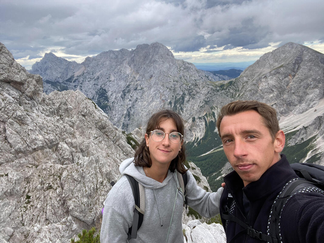
The start of the hike was pretty pleasant as we were walking through the trees on a trail covered with pine needles, until we reached the hut which ment the hike in the mountains was about to start for us. After a beer, we decided to hit the trail, hoping that we could reach the Mrzla Gora summit at lunch time. We were definitely not prepared for what was awaiting us a few kilometers ahead of us. Even though it was not a steep ascent from the beginning, the trail was still demanding as it was mainly composed of small rolling gravels that made each and every step a little challenging. After battling against rolling gravels and slippery rocks, we finally reached the interesting part of the ascent: the point where the hike turns into a climb. At one point, when we reached the rockies, the trail became a way through very steep rocks where only a cable is there to help you pull yourself up, sometimes we also had metal pieces in the rocks to step on, it was challenging but so attracting. So after a couple of hours of hiking and climbing we reached a point that was almost the top of Mrzla Gora but realized that we had to climb up to then climb down on the other side of the mountain to finally climb up again to reach the summit of Mrzla Gora, so we decided to end our ascent there. 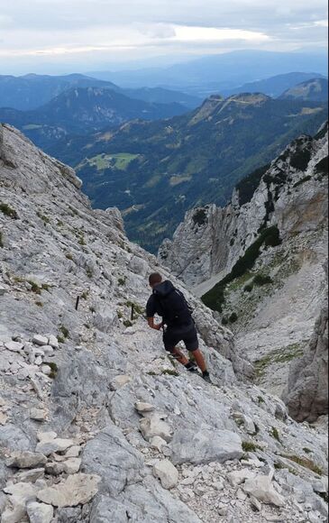
Once we ate a little something, we made up our minds on going back down, struggled a little in some spots, missed the trail, ended up hiking down 300 meters of elevation to then hike up 200 meters to go back on the trail, and finally got some rain. So as that was all exhausting, we obviously had another beer when we got back to the hut!
See you on our next adventure! When a place is considered home? We are living in this paradise from several month, and living in the orchard made me reflect on this, so I took a pencil and let my feelings drive my hand towards what I am considering home now.  |
AuthorWrite something about yourself. No need to be fancy, just an overview. Archives
November 2022
Categories |
 RSS Feed